
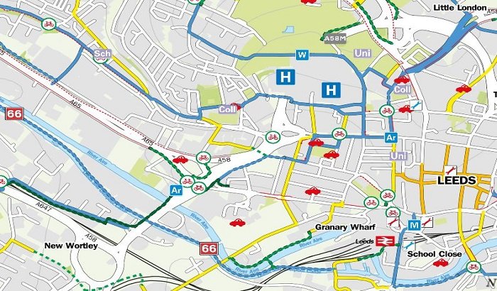
A new digital on-line map offering a wealth of information to keen and would be cyclists in Leeds and West Yorkshire has been launched.
Developed in partnership with four other local councils’ and the West Yorkshire Combined Authorities’ City Connect team, the West Yorkshire Digital Cycle Map provides cyclists with details of cycle routes, tracks and paths in Leeds and in towns and cities right across the district.
Through the interactive map, cyclists can plan their journey seamlessly across the district boundaries and ride across Leeds and West Yorkshire with confidence. Not only does the map allow for users to zoom in and find out where the best on-road and off-road routes are in Leeds, they can also discover the finest leisure rides, where to find bike parking, and even where local bike shops are situated.
The newly opened City Connect Cycle Superhighway between Crossgates, Leeds city centre and Bradford also features on the map, with a journey planner available to plot point to point routes to give the quickest or quietest ways.
Councillor Richard Lewis, Leeds City Council’s executive member for regeneration, transport and planning, said:
“I am delighted to see the introduction of the West Yorkshire Digital Cycle Map, which will provide people who love to get on their bikes with an excellent resource to tailor their rides not just in Leeds, but right across the district.”
 Drug Arrests After Police Raid in Allerton
 Appeal after serious collision on Vicar Lane in Leeds
 Leeds 400 challenge launched to get city moving
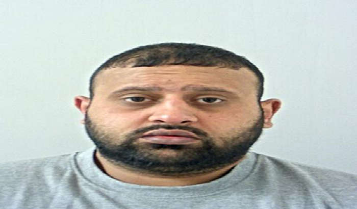 Accrington drug dealer jailed for 10 years
 Culture at the Heart of Stockport’s Transformation
 South Asian Art Exhibition Opens at Cartwright Hall
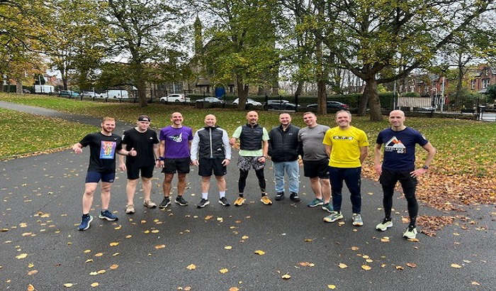
 Men’s Mental Fitness Programme Launches in Blackburn
 Council Calls for Tougher Fly-Tipping Sentences
 Man Jailed for Raping and Exploiting Vulnerable Teen in Stockport
 Free Midsummer Festival to Return to Milton Keynes
 Leeds Sets Out ‘Landmark Year of Opportunity’ for Major Projects
 The Golden Era
 Legal Show
 Alim OnAir
 Bhangra Nights